Most residents are familiar with our winterbourne, the River Lavant. Winterbourne because it is a seasonal stream that comes down from the Downs, filtered out of the chalk after the Winter rains.
Most of us are familiar with its current course on the West side: emerging from the City from underneath the Fountain public house on South St; dividing at the pedestrian bridge by the Southgate car park; with one branch continuing to the station and the other flowing along the exterior south-west quadrant of the walls; under the Avenue de Chartres and Mount Lane and onto the Tannery by the College; and so to the harbour in between Fishbourne and Dell Quay.
Fewer residents know however that the Lavant still continues to flow under Westgate.
How can this be?
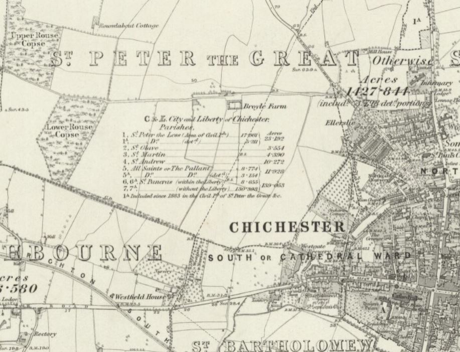
The Lavant has many branches and it is now impossible to tell which is the main one. The Romans are rumoured to have been the first to reroute the river as it came down from the Downs, to provide fresh water to the new garrison town they had founded in 43 AD. Fresh water was essential to the proper functioning of any Roman town, often provided by an aqueduct that rerouted a local water course to bring water to the citizens. As the above map shows, in Chichester, they rerouted the Lavant to flow away from its original course down to Pagham Harbour, to redirect it around the south of the town to feed the water system, under what is now Orchard Street and then on into the sea at their landing point at Fishbourne, near where their vassal Cogidubnus had had his outrageous palace built.
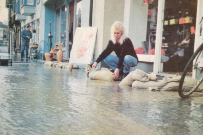
However, it is unlikely that any of the watercourses we see today date from that period. A lot of these watercourses will be mediaeval or later in fact and most of them continue to exist, although the Environment Agency did a major job of rerouting the river back to its original course into Pagham Harbour after the bad floods in January 1994 which hit the national news.
Map evidence
Residents will be aware that there were a brewery, a slaughterhouse and a tannery in close proximity along Westgate. Cemeteries (there is one under the garages in the Georgian Priory and on the Tollhouse Close site), and polluting industries like these, always being placed outside the city walls and downstream of the water supply for obvious reasons.
All these industries needed water but the river surely flows too far to the south of these sites to be much use. Or does it?
If you look at our oldest available map, John Norden’s map of 1595, you will see the line of the river swings to the north and loops back to the south passing under the Squittery Bridge to the West of the City. It is clearly marked here on the lefthand top quadrant:
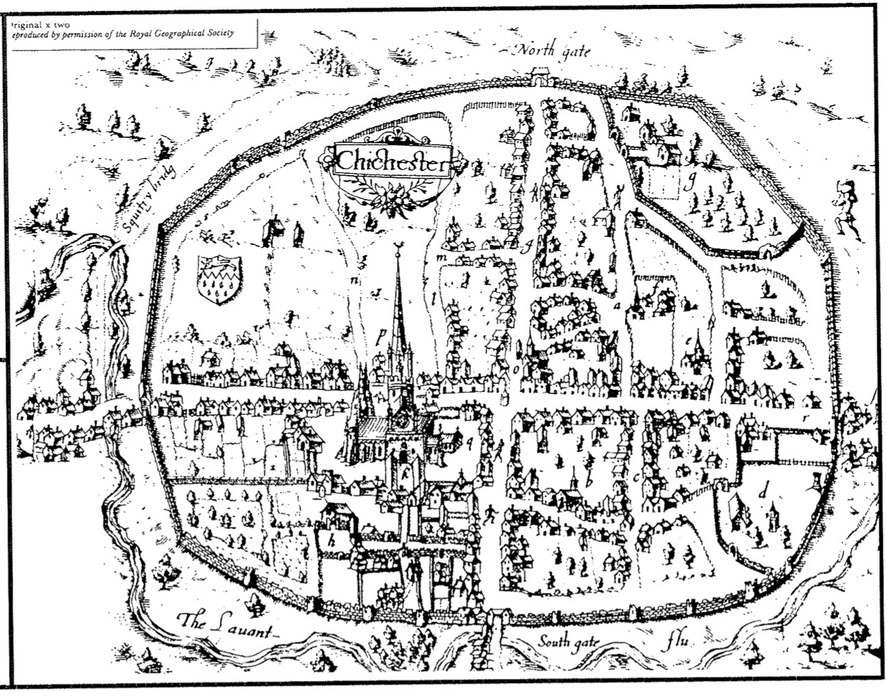
Squittery Bridge carried Orchard St over the Lavant at a point opposite where the Chichester Foodbank currently sits and where the Westgate cannon was found encased in mud in the 1980s. Which demonstrates also that the bridge was still in use in the mid 18th century.
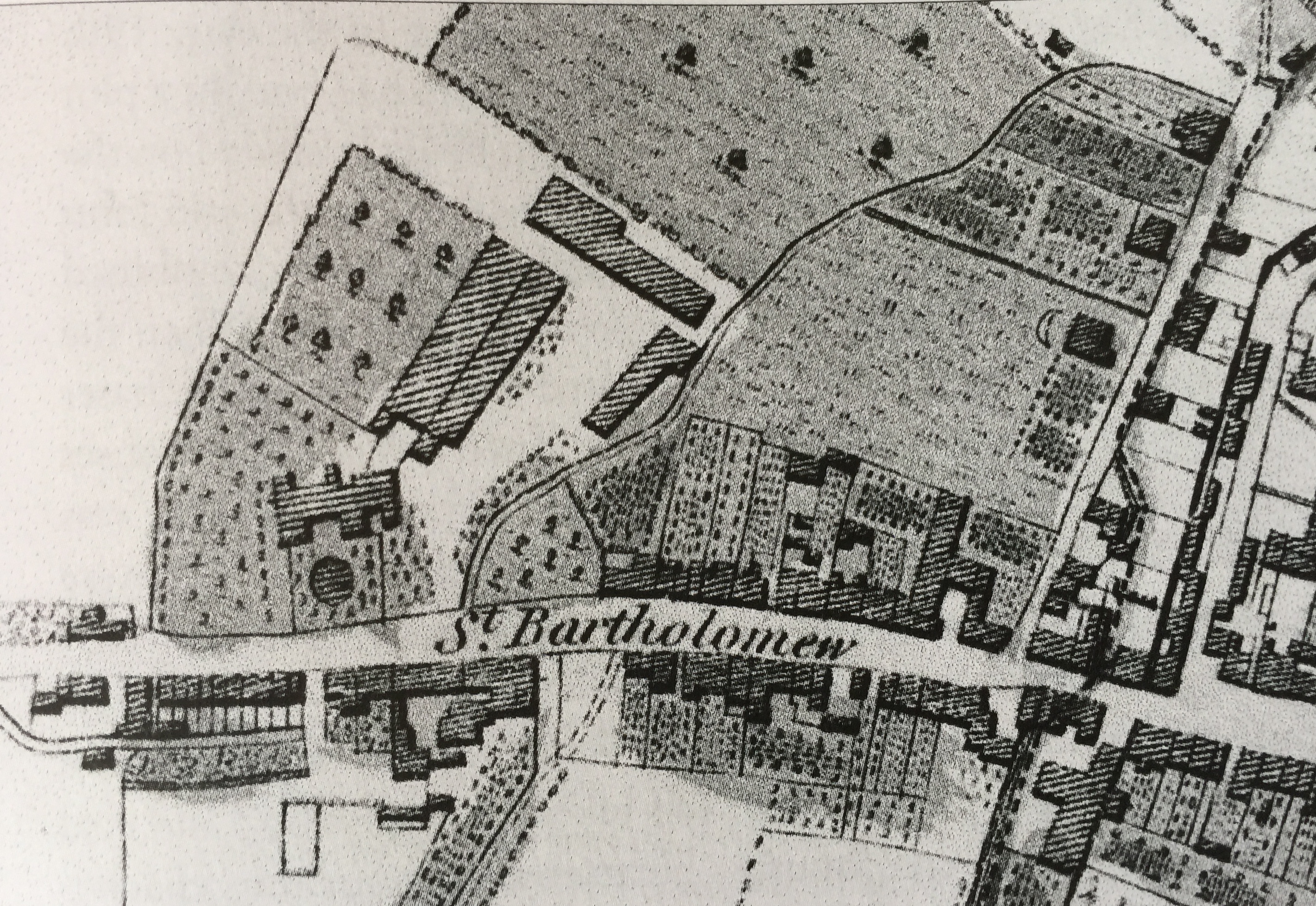
Other maps confirm this course. The line of the culvert as it was in the early 19th century is best shown on the St Bartholomew’s Tithe Award Map, which you will need to go to the Records Office to see. The river comes down from the bridge across Orchards St (off map) into the brewery complex, under Westgate to the Shippam factory and with a ninety degree turn to the west, on to the Tannery:
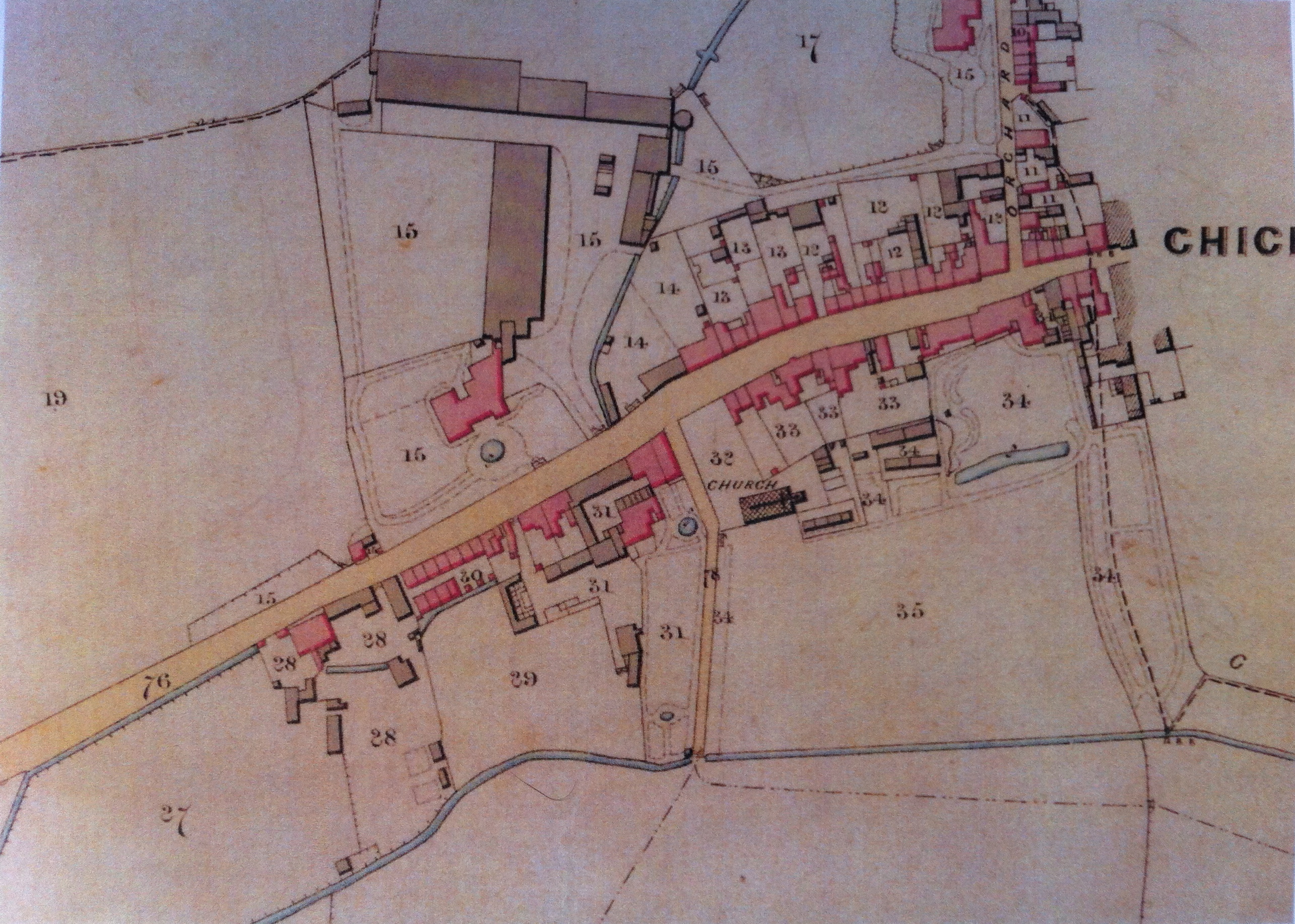
This detail of the earlier William Gardner map of 1769 clearly confirms the line of this watercourse going up the right hand side of Orchard St, under the road at the bridge before coming down through Brewery Field, onto the brewery site, crossing the road into the Shippam’s yard and on to the Tannery next door :

Ordnance Survey
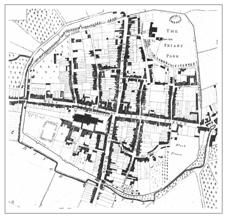
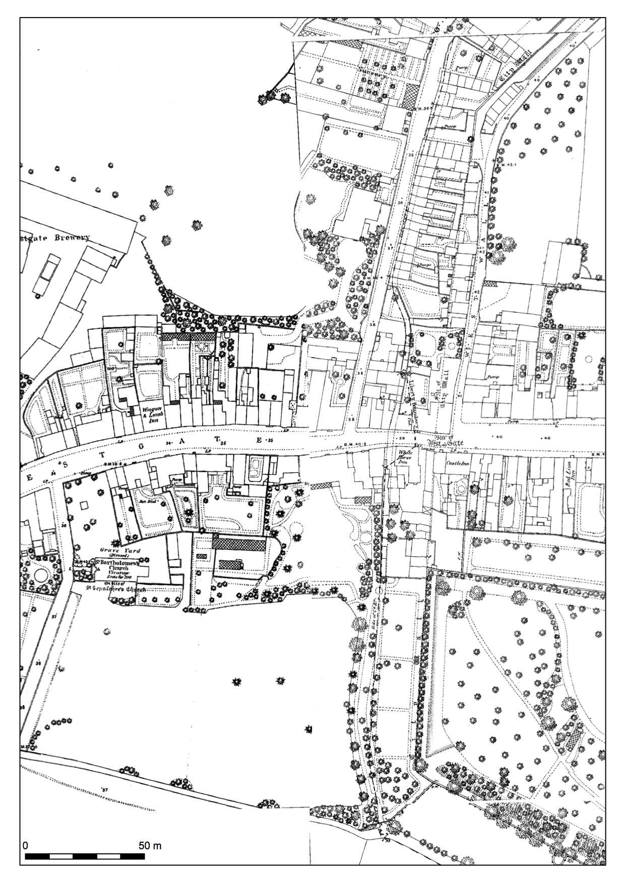
By the time this more contemporary map was printed, the OS map of 1875, which obviously predates the building of the Avenue de Chartres, the northward flowing branch of the river has been put in a culvert, which is why we no longer see any evidence on the surface.
The 1:500 version of this map shows that it has been enclosed in a culvert close to what is now the line of Avenue de Chartres. This continues north before crossing Orchard St. You can follow this culvert on the map below, as it snakes north up from the south west corner of the walls, along the east side of what must have been the rather magnificent garden of what is now the Georgian Priory, and on up the east side of Orchard Street. You can just make it out as it turns westward at the very top of the map, and the fragmented line of the hedge and trees then running south and the curved shape of the boundaries all seem to indicate the course of the old river bank.
Industrial evidence
If you go into the Brewery Field in a particularly wet Winter, you will discover a damp hollow a few yards west of the entrance. Looking north you might just make out the faint indentation of the culvert trench passing to the East of these trees and coming South into the Brewery site, under what are now the garages of Henty Gardens and the row of nos. 19-23.
The Brewery
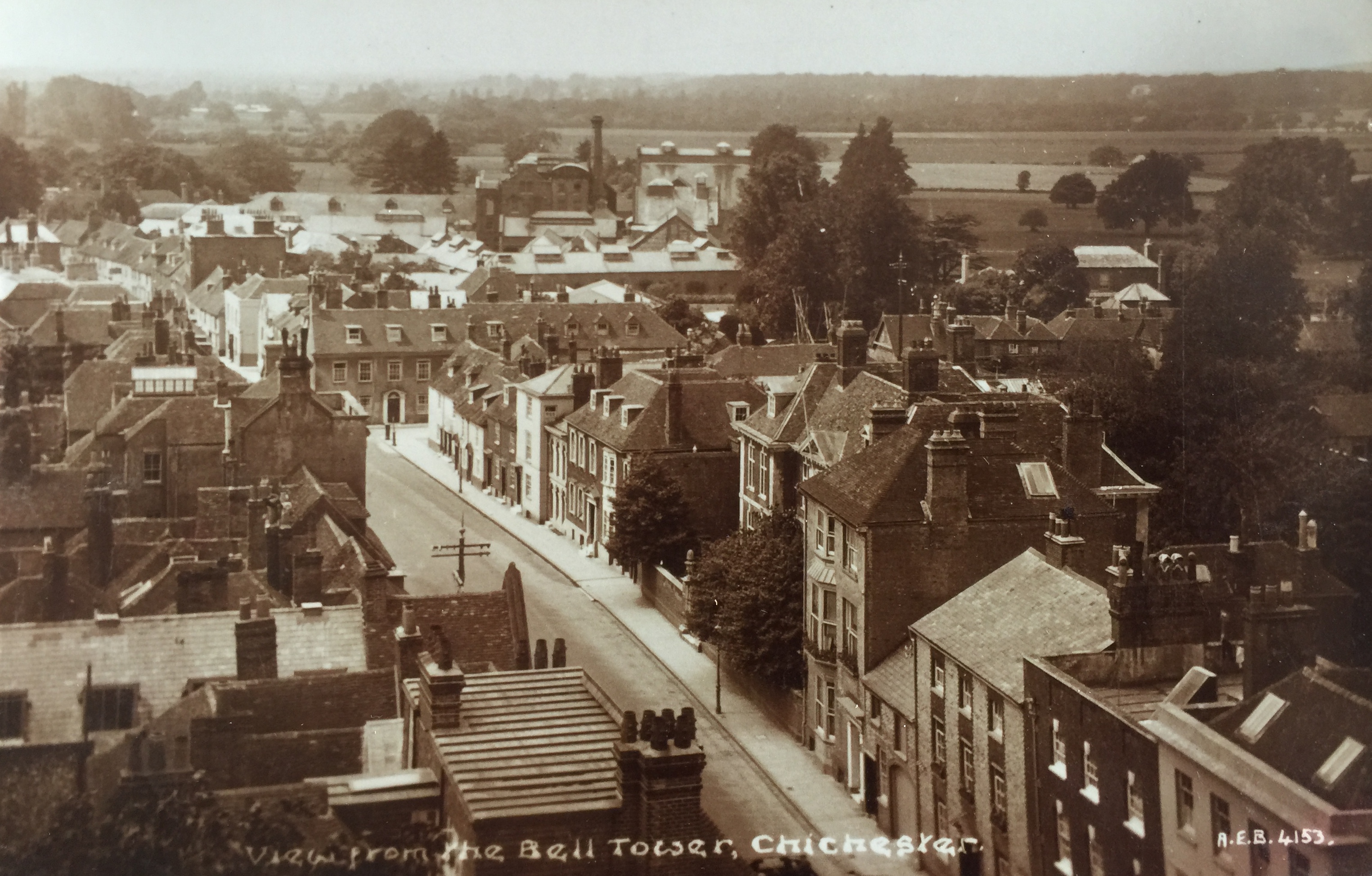
The brewery was the first (and cleanest) of the three former industrial sites on Westgate whose industries relied on water. You can gain some idea of the full extent of the site from this early photograph looking West from the Cathedral Bell Tower. The row of houses set across the road in the middle distance are where the North Walls exited onto West St at the famous pinch point, and marks the formal beginning of Westgate prior to the demolitions of the sixties. The industrial complex of the Brewery occupied much of the site behind, which is also one explanation for the bizarre allocation of the back garden boundaries of nos. 20-48 Westgate, all houses eventually commandeered by Henty’s for use by the Brewery as it expanded.
It is no mistake that the brewery came first in the row since the water would have been siphoned off to make the beers and had to be clean(er).
Shippam’s meat
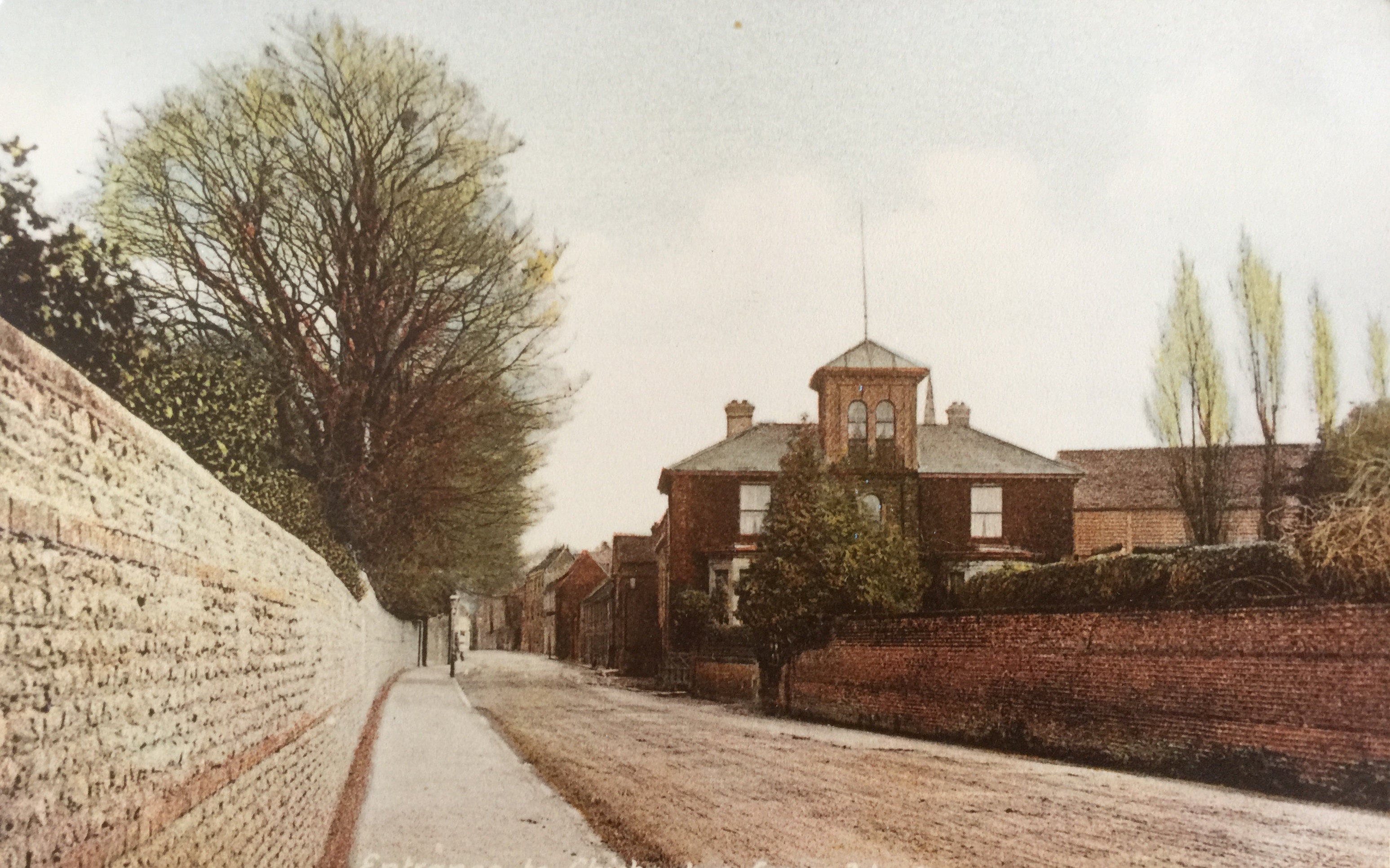
This branch of the Lavant then crosses underneath Westgate, leaving no modern evidence on the surface however, opposite the taller houses in the “Shippam row” which used to be their warehouse, probably directly under no. 33 and into the stables and slaughterhouse area. The set back top window on this photograph is what is left of the hoist opening at the top of this property.

It is thought Shippam’s slaughterhouse was situated where no 1 St Bartholomew’s Close now is. It is possible that the remaining northern wall of this structure still backs onto the gardens of nos 37 and 39 although it had become a stable in later years.
The Tannery
From this point the river flowed out of the slaughterhouse and on to the tannery, the filthiest and most polluting of our three industries. If you know anyone living in the row of workers’ cottages further West of St Batholomew’s Close at nos. 41-59, they will tell you that the river runs through the bottom of their gardens and into the Tannery site.
The end of the culvert
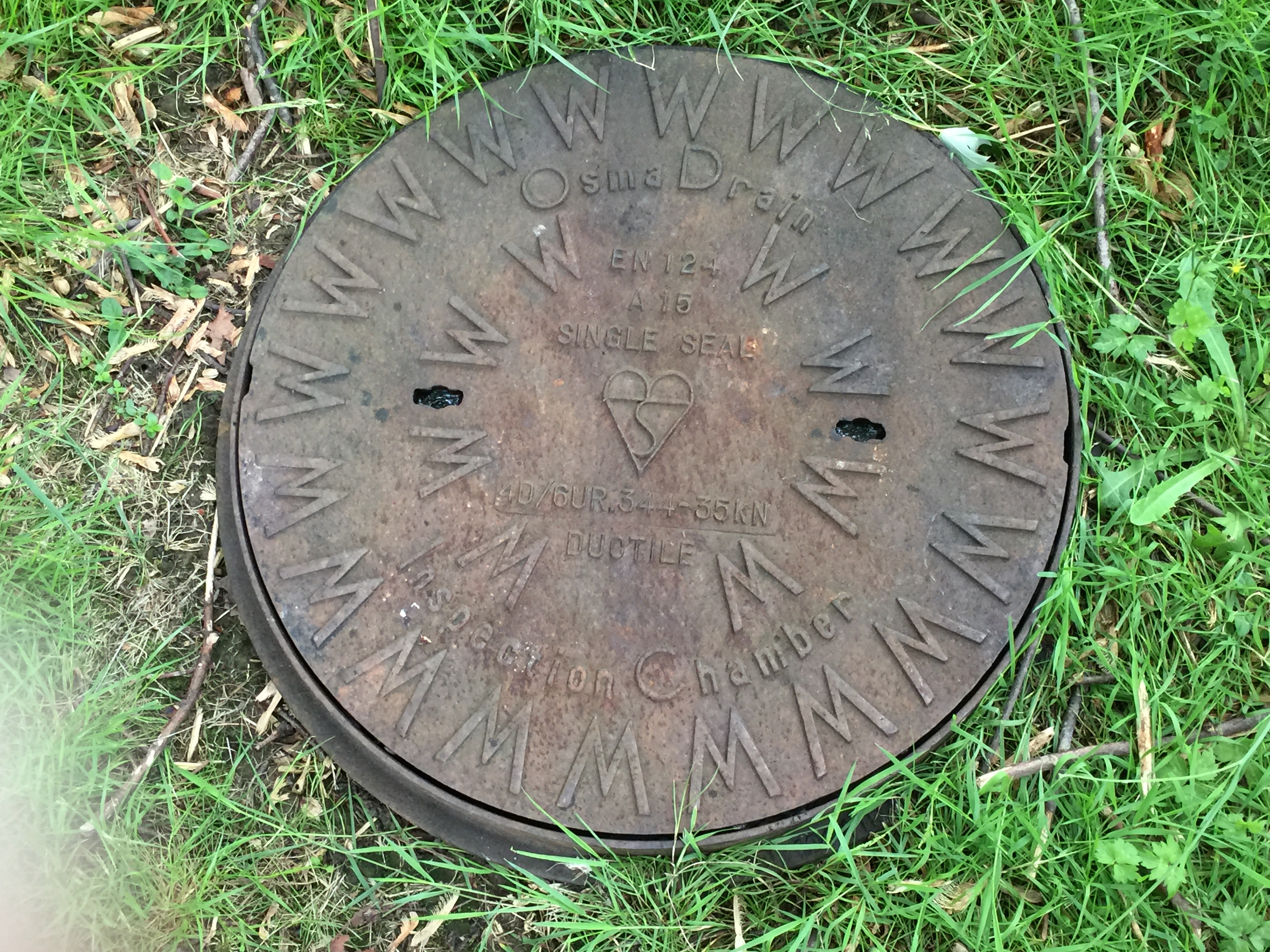
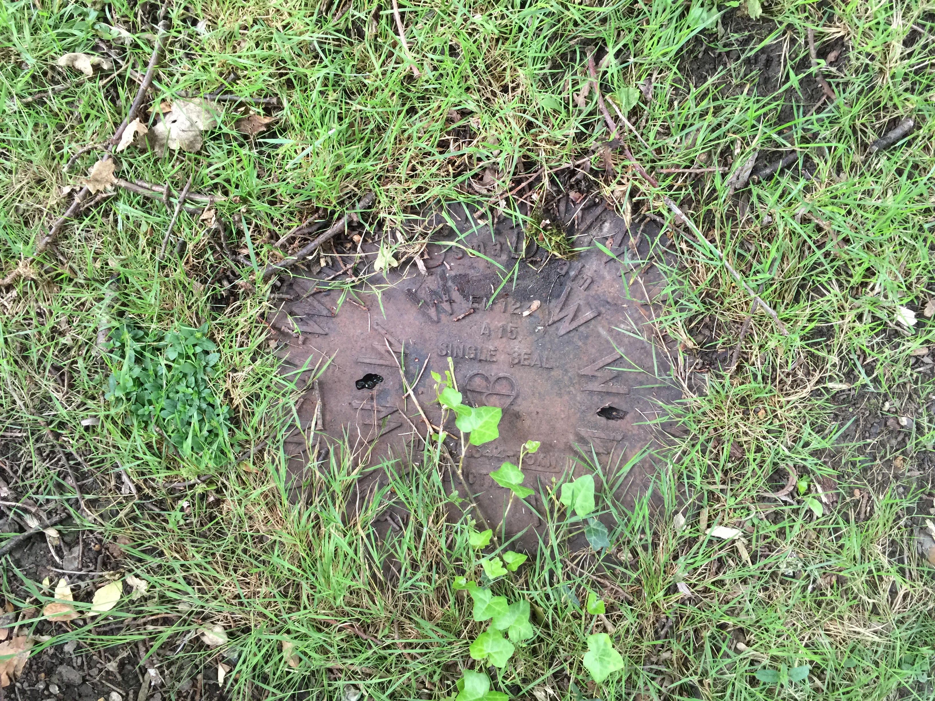
Finally here the physical evidence of the culvert appears on the surface.
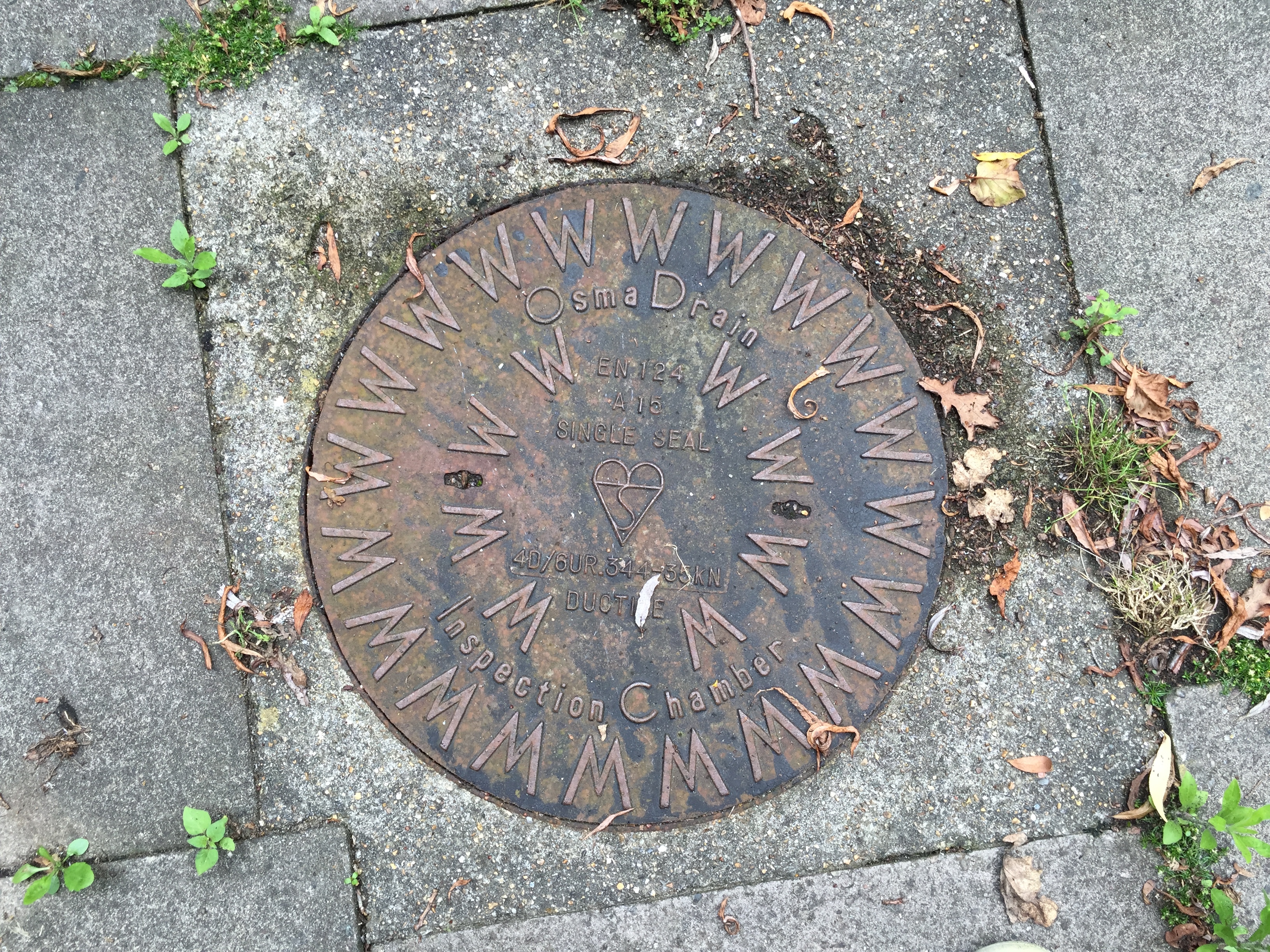
If you walk through the old gates to the Tannery offices you will discover three of these round inspection chambers on the old Tannery site leading south.
West Sussex County Council
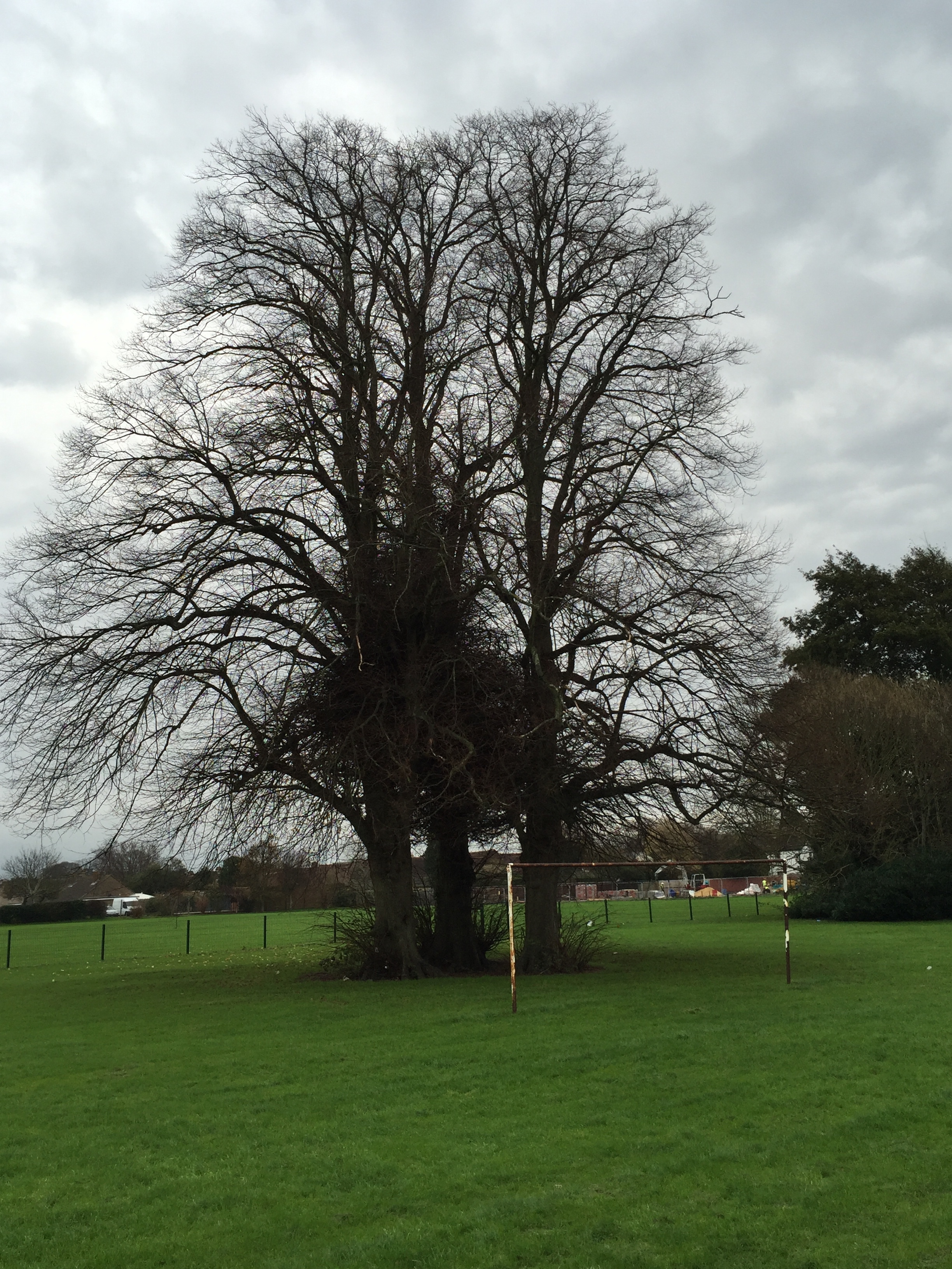
In the 70s the Tannery site was bought by the County Council and among the inspection chambers situated along the banked culvert on the East edge of the site, you will find this commemorative tree, a handsome oak that obviously loves being on top a of a continuous source of water!
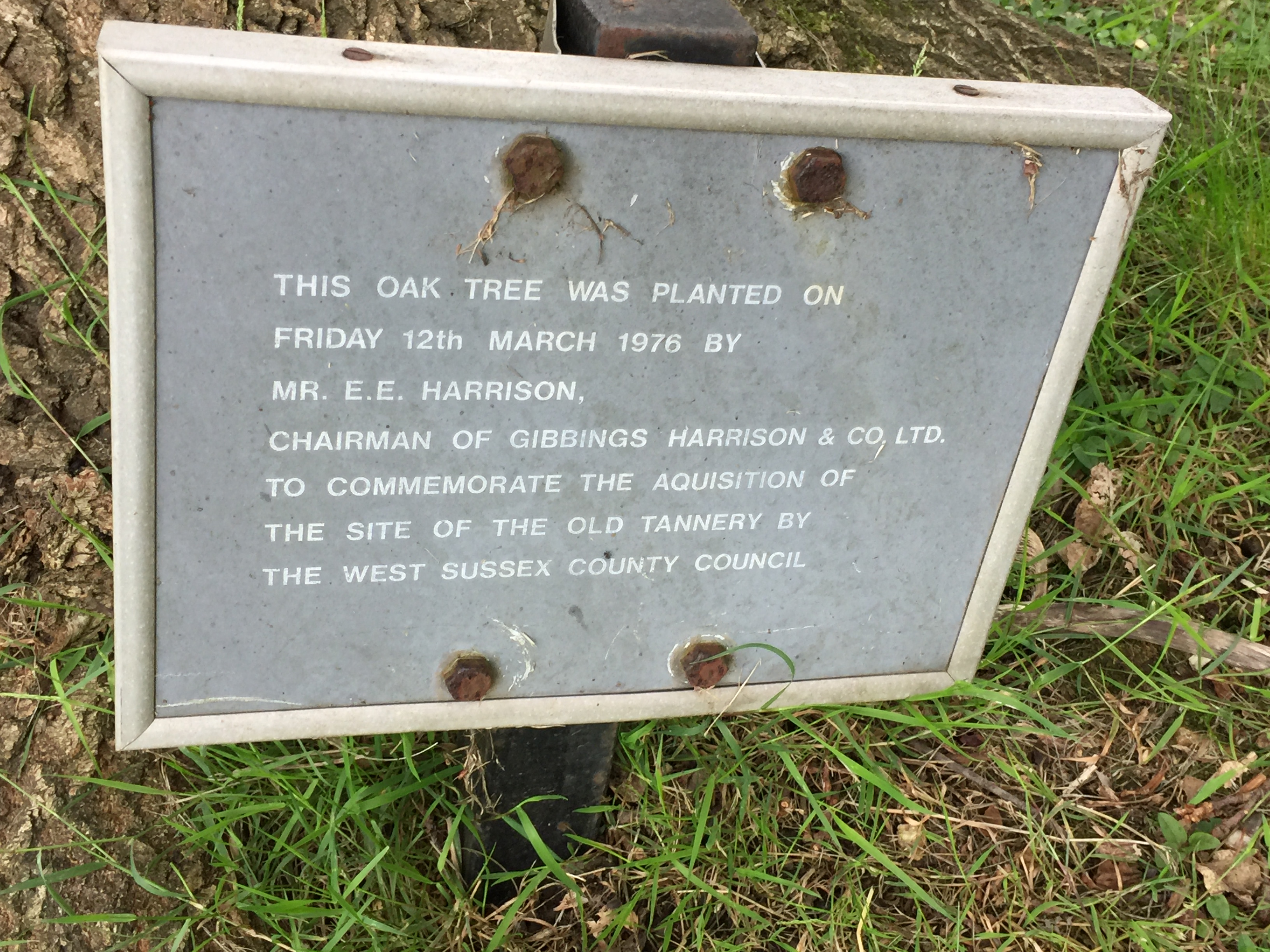
Indeed the site remains a model of sensitive municipal tree planting, from a time when County Councils had money and controlled their own policy. Currently several of the trees on the site are in danger of being heavily pollarded and the Committee are considering a response (April 2017).
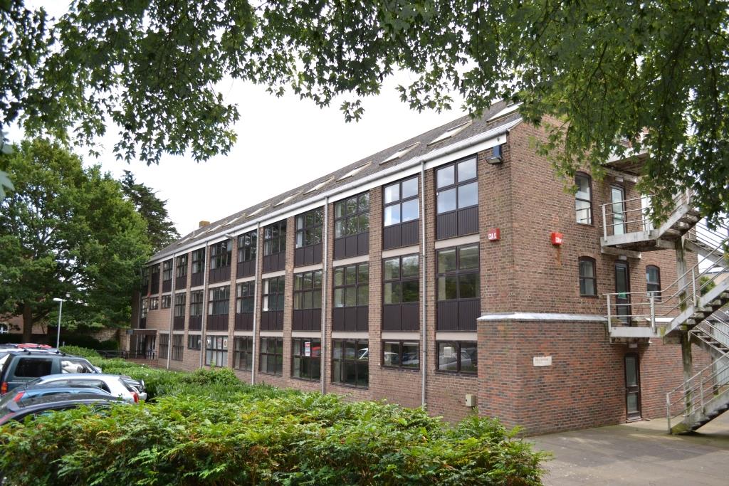
The Edwardian industrial Tannery building itself was remodelled and reskinned at the same time into an anonymous office block; but make no mistake, the metal structure holding all this up is the 1905 one. It is the last industrial structure still standing on the street but now considered too dangerous to be restored and so has been quietly scheduled for demolition.
End of the Westgate Lavant journey
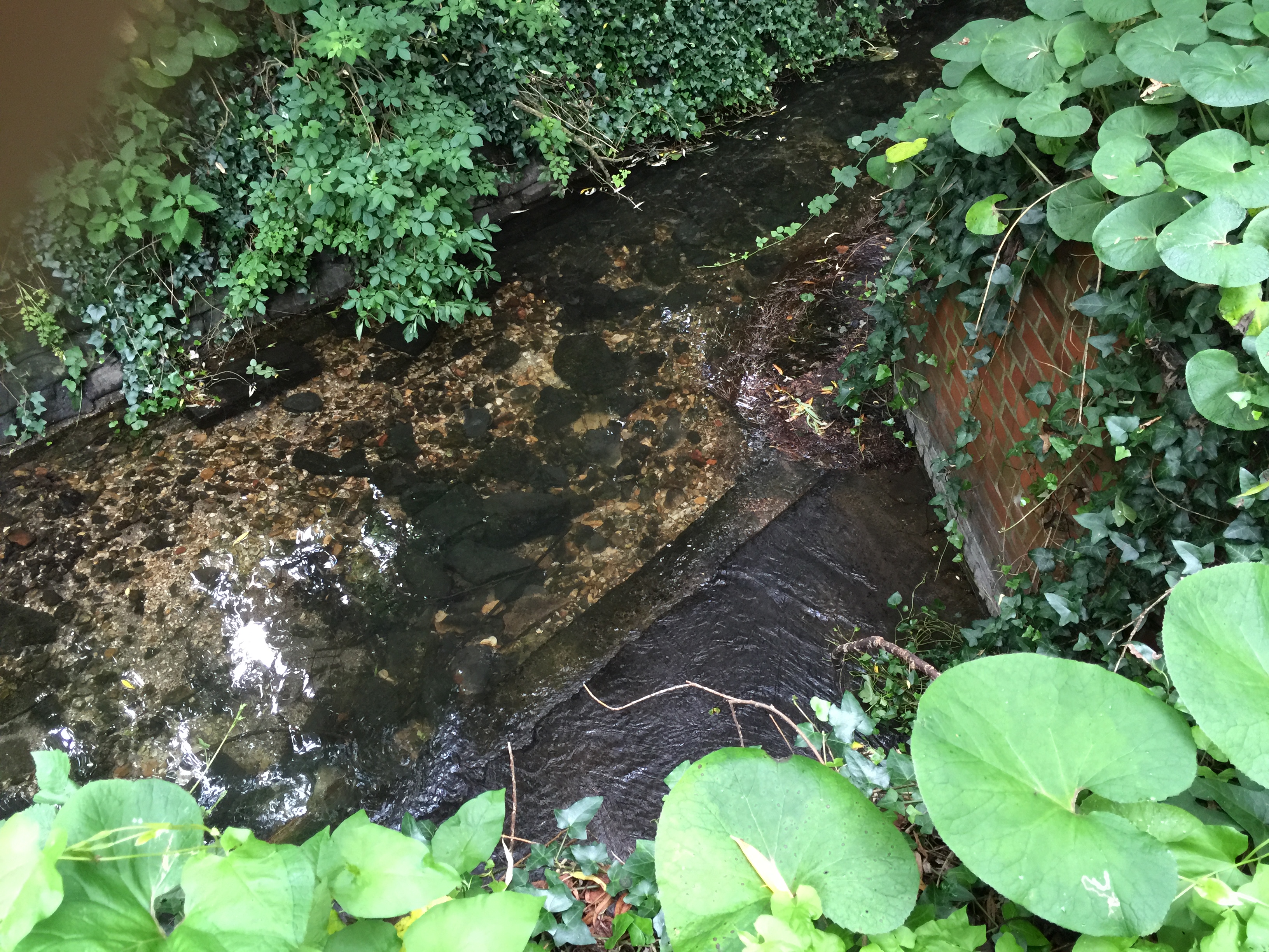
At last the river emerges for the culvert at the southern boundary of the Tannery site facing the College site, and rejoins the branch that crosses the Avenue de Chartres at the south-west corner of the walls and along the boundary separating the Tollhouse Close site from the Chichester College playing fields. Water seems to flow here all year, which is probably why the industries used this branch since a regular supply of water would have been essential to their business success.
If you have any further information or photos on this item please submit them. Thank you.