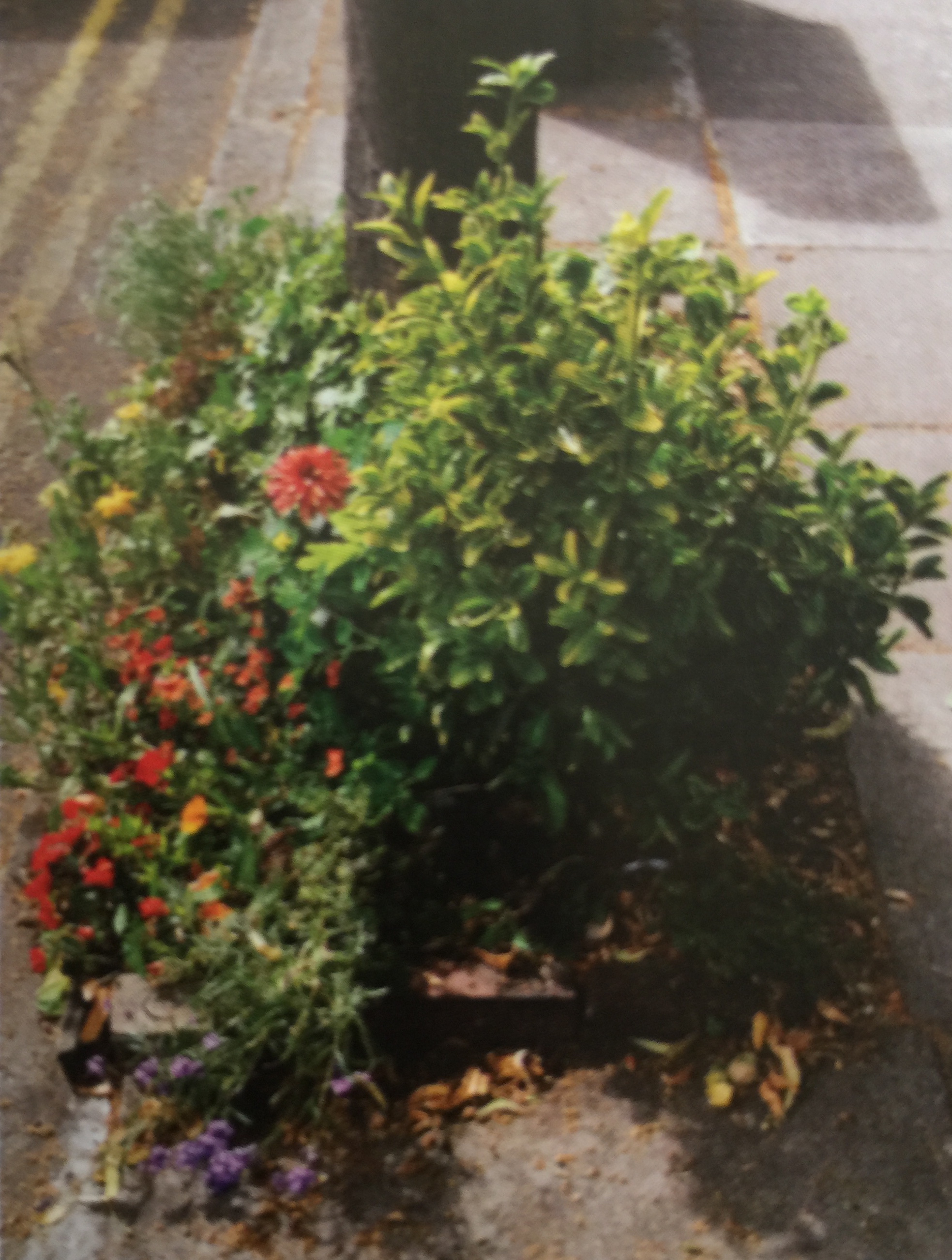
We are grateful to Brian Raincock of 4 Mount Lane for doing this survey of the state of our planters and public spaces along Westgate. The Committee is in negotiation with the City Council to take over the management of these spaces and Penny Tomlinson of 11 Westgate has agreed to take on the coordination… Continue reading Westgate Planter and Public Space survey
Author: Colin Hicks
Site Admin - Westgate Residents' Association Chichester
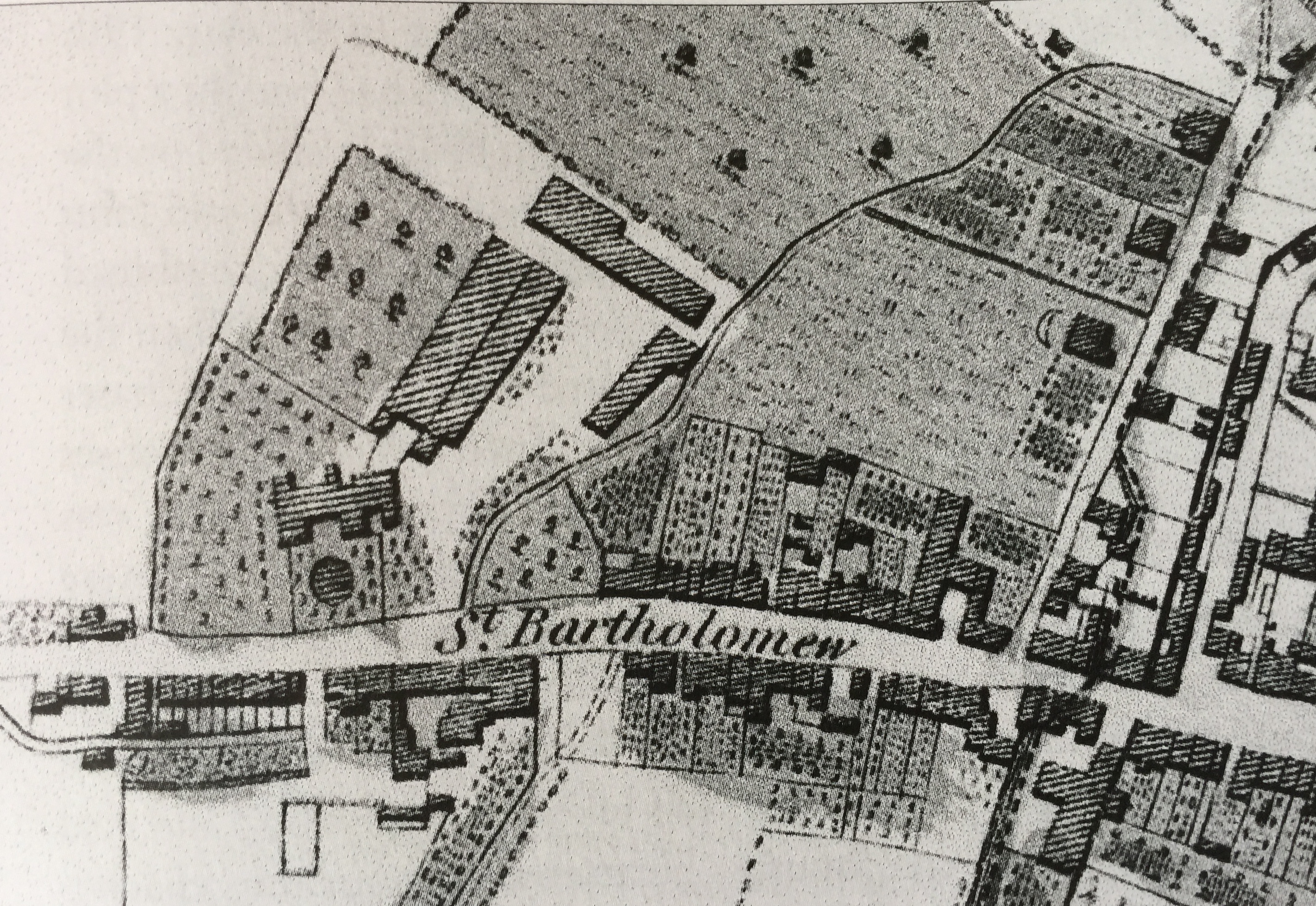
The Rebuilding of St Bartholomew’s Church, 1824-32
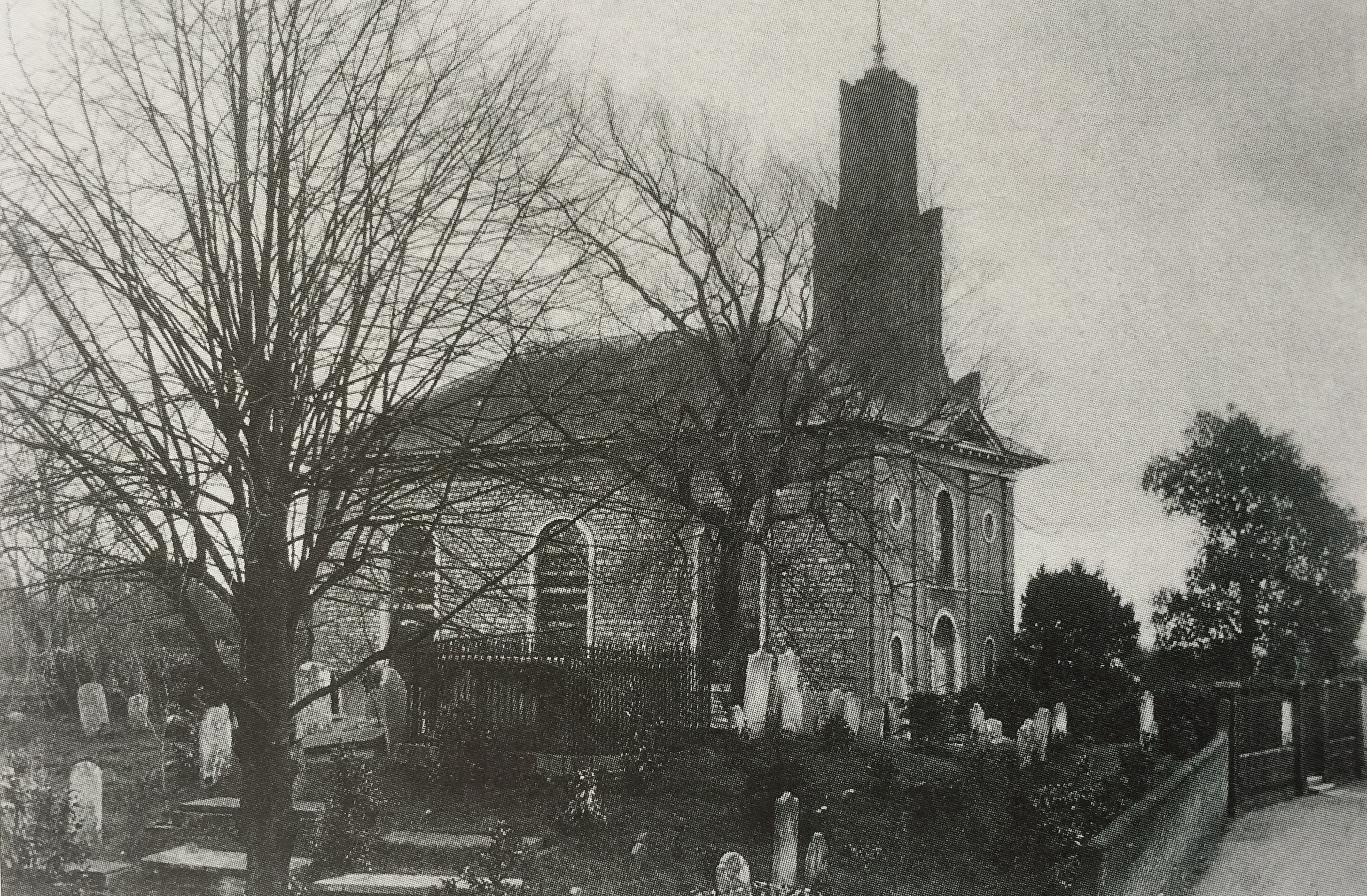
Following the destruction of the “Round Church of St Bartholomew” by William Waller’s Parliamentarian troops in December 1642, the congregation were without a church for 190 years. Only the burial ground was left but the parish still existed, its vicar and churchwardens remaining in office and the tithes still being collected. Until 13 March 1824,… Continue reading The Rebuilding of St Bartholomew’s Church, 1824-32
The Organ of St Bartholomew’s Church
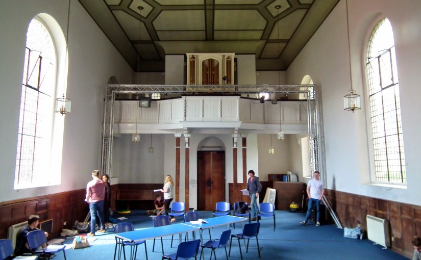
A chance encounter with Alan Thurlow, retired organist of Chichester Cathedral, has enabled us to do some more research into the pipe organ which may still be seen inside St Bartholomew’s church (once we can get access!). Details of the St Bartholomew’s organ can be found under Survey E00701 on the National Pipe Organ Register… Continue reading The Organ of St Bartholomew’s Church
Chichester & St Bart’s: the Municipal Area
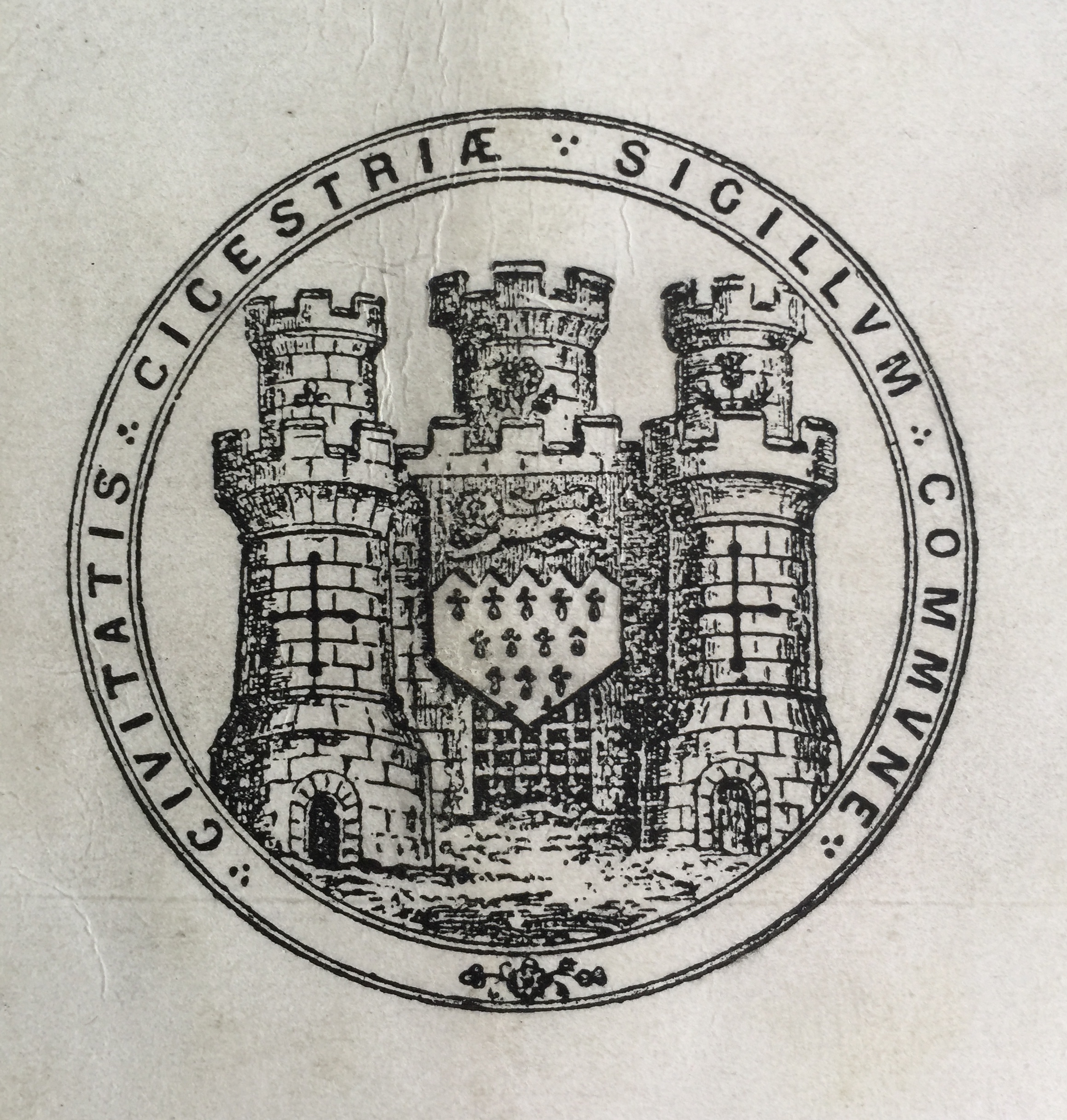
Prior to the Norman Conquest of 1066 the municipal area of Chichester is not known. From the late 9th century, Alfred had founded his network of Saxon burhs. These lay at the centre of Alfred’s reformed military defence system and were distributed at strategic points throughout the kingdom. Many were former Roman towns, the largest of which was… Continue reading Chichester & St Bart’s: the Municipal Area
Old Maps of Westgate and Chichester 1

Since the launch of the website we have sought to develop our historical archive. Here is a collection of old maps upon which figures Westgate and its surrounding streets in one form or another. 2007 – I know, we are starting with a recent map, but there are no printed Roman maps in existence of… Continue reading Old Maps of Westgate and Chichester 1
Developing The Brewery Field – March 2016
On 11th March the Steering Committee officers had a meeting in the field with Mikey Pearce of Forest Schools, and Sue Long, the CDC Community Warden for Chichester West. The Steering Group is keen to respect the wishes of the general meeting held at the end of 2015 that the field should be a natural… Continue reading Developing The Brewery Field – March 2016
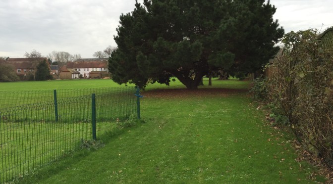
The Westgate Tree Walk
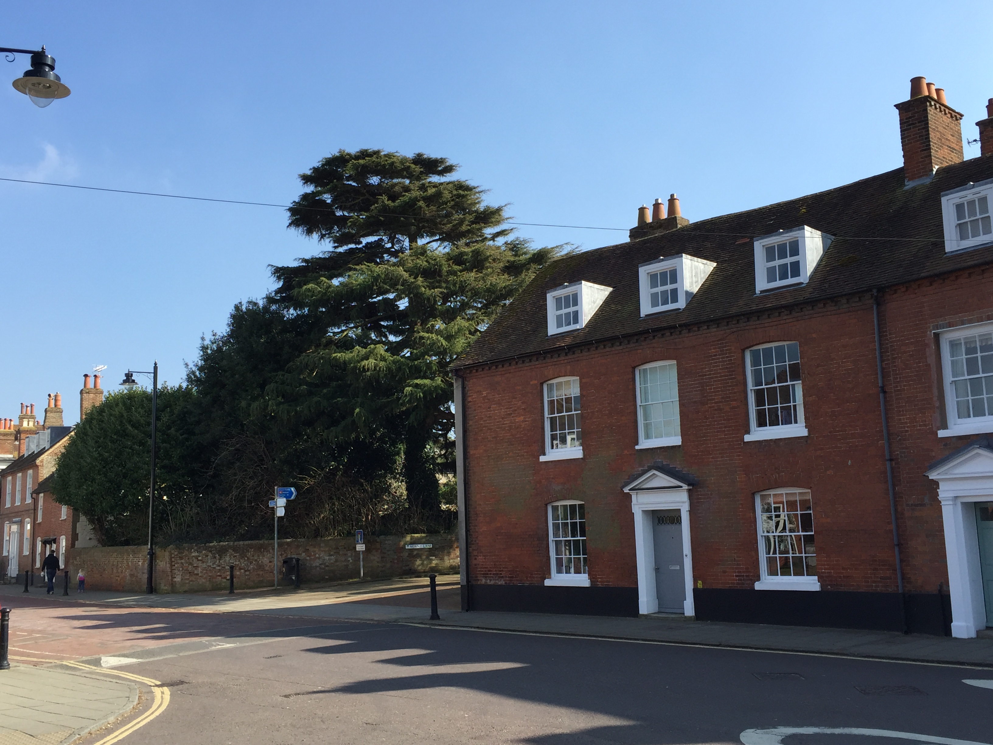
If you are interested in our local trees, then why not join us this Summer as part of our social programme when we will be walking down Westgate with our Tree Warden, Dr Brian Hopkins of Henty Gardens, to check on the catalogue of our protected trees and update it? The walk will take place on… Continue reading The Westgate Tree Walk
The rules of the TPO (Tree Preservation Order)
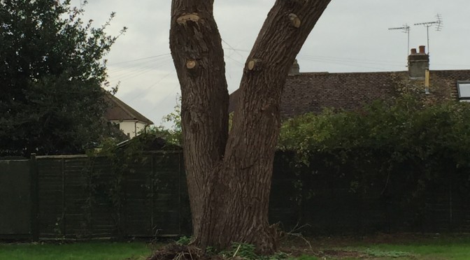
Due to recent relaxation of the planning regulations by the current government and the disappearance of some trees for various other reasons, it is not easy to produce a reliable list of the protected trees in and around Westgate. We are therefore grateful to Dr Brian Hopkins, our local tree warden, for the work he… Continue reading The rules of the TPO (Tree Preservation Order)
Westgate’s Landmark Trees (updated)
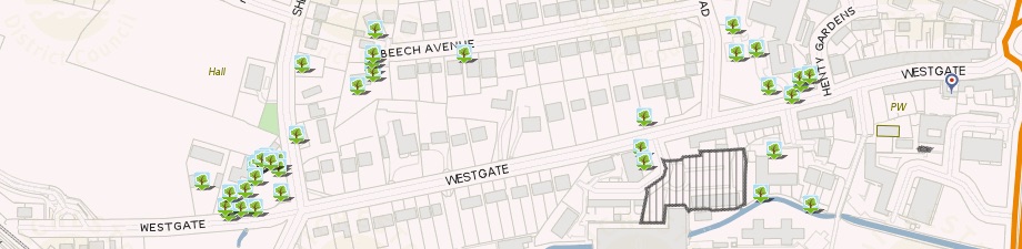
Originally posted on 12 March 2016, updated on 13 June 2016. If you would like to help us keep this list up-to-date then do write in with any changes you have noticed, or join Brian Hopkins, our tree warden, on the 25th June Westgate tree walk. All tree photos are by the author unless otherwise stated. Our protected trees… Continue reading Westgate’s Landmark Trees (updated)
The Westgate Brewery part 1
From time to time we bring in a guest writer to add to the content of our website. We are grateful to local historian Alan H. J. Green for his permission to reprint this article which originally appeared, entitled “The Westgate Brewery”, in the Sussex Industrial Archaeology Society Newsletter 137 of January 2008. And also to… Continue reading The Westgate Brewery part 1